The Google has an option that allows you to calculate distances between various points on Google Maps. The system is useful for measuring the stretch between random points, especially in places where there are no streets, in parks or in rural areas. Follow the steps below and see how to use the tool in the new Google Maps or the classic version.
Step 1. Click the right mouse button at the starting point. In the menu that appears, click "Measure Distance";
Step 2. A point is added to the map. Click the left mouse button to add new points. You can do this randomly without following the path of a street or highway;
Step 3. If you added a point in the wrong place, click on it again to remove it. If you only want to change a point of place, just click on it and drag;
Step 4 To add new points within a segment, just click a point on the line and drag;
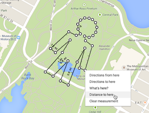
Step 5. Finally, to clear the map, click the right mouse button on any point. Then click in the menu "Clear dimensions";
Google Maps Classic
Step 6 If you are using the classic version of Google Maps , click "Labs Google Maps" in the lower left corner of the page;
Step 7 Enable the "Tool for measuring distance" and click "Save Changes" option.;
Step 8. Click the Ruler icon in the lower left corner of the map. In the left pane, you can select whether to use metric or English to calculate distances;
Step 9. Finally, to measure the distance, click the left mouse button on the map to trigger points. In this case, you can only change the position of the first and last point;
Step 10. On the left panel of Google Maps, the total distance will be displayed. If err a point, click "Delete last point" or "Reset" to clear the path.
Ready. With the tool, you can calculate distances between any point. It is important to say that Google Maps does not consider the sloping ground, ie, depending on the path, the margin of error can be large.


Comments
Post a Comment